|
|
|
Project
Experience |
|
| Project: |
CARBON COUNTY
LAND USE PLAN |
|
|
| Location: |
Carbon County, Wyoming |
|
|
|
Client: |
Board of Carbon County Commissioners
P.O. Box 487
Rawlins, Wyoming 82301 |
|
|
| Contact: |
Henry Hewitt, Chairman, Carbon County Planning
Commission |
|
|
| Year Completed: |
1998 |
|
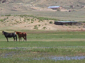
| Project Scope:
Carbon County, Wyoming, is a rural
county encompassing almost 8,000 square miles in southcentral
Wyoming. The County contains a resident population of about
16,000 residents who reside in ten rural communities. Municipal
areas are surrounded by extensive rangelands lands and
undeveloped areas. The economic base of Carbon County includes
six primary industries that include ranching and agriculture;
timber; oil and gas; mining, transportation and tourism. A
diversified service sector supports these industries.
|
|
| The comprehensive land use plan
recommends future land uses in Carbon County, and strategies for
future land management. Preparation of the plan was driven by
County concerns regarding the future economic viability of
primary industries, the availability of future water resources,
the conservation of wildlife habitat, scenic vistas, and other
natural resources, gradual signs of growing land speculation,
and other community issues. |
 |
|
| The County Land Use Plan examined
community issues and priorities, the regional economy,
population, the environment, as well as future land and resource
management. Land use information was placed into a convenient
database that enables Carbon County to track long-term changes
in land uses and zoning. Forecasts of future population growth
were developed through the year 2015. The forecasts were
incorporated into a dynamic, statistical model that can easily
be changed to reflect future changes in employment, residential
land uses, or future Census estimates. An extensive community
participation program was organized to gain the insights,
concerns and desires of the residents concerning a variety of
land use, economic, and environmental issues. Three rounds of
public meetings were held in four different locations within
Carbon County. PPC also developed surveys for residents, small
business owners, and ranchers to better assess community issues
and concerns.
PPC also established a
geographical information system (GIS) using ArcView software.
Selected public data was made available to Carbon County by
federal and State agencies. Subsequently, available data was
scanned, digitized, and incorporated into the GIS for Carbon
County.
The Carbon County Land Use Plan
was adopted by the Board of Carbon County Commissioners in May
1998. |
|
|