|
|
|
Project
Experience |
|
| Project: |
WRIGHT
GEOGRAPHICAL INFORMATION SYSTEM UPDATE |
|
|
| Location: |
Wright,
Wyoming |
|
|
| Client Address: |
Town of
Wright
P. O. Box 70
Wright, WY 82732 |
|
|
| Contact: |
Christy
Hale, Town Clerk |
|
|
| Year Completed: |
2008 |
|
| Project Scope: |
|
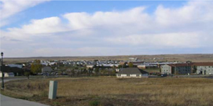
| The Town of Wright
desired an update to the Wright geographical information
system (Wright GIS). This system was originally
established by PPC in 1998 during its development of a
revision to the Wright Municipal Master Plan. |
 |
|
| Several
years later, a tornado generated some unexpected changes
in land use that were never incorporated into the Wright
GIS. In addition, planned staff changes in municipal
staff required some training of municipal staff to make
effective use of the Wright GIS to day-to-day municipal
operations and decision-making. |
|
| The update
of the Wright GIS began with the procurement of a newer
version of ArcGIS software for the Town of Wright’s
computer system. Subsequently, PPC conducted a new
inventory of community land uses on every lot and parcel
in the community. Recent land ownership information was
obtained from the Campbell County Assessor and linked to
the digital base map of the community. The existing land
parcel layer was modified to incorporate recently
subdivided lands. Infrastructure information on roads,
water, and sewer systems were also revised using
available data from the Town of Wright’s municipal
engineer. PPC also
obtained and incorporated selected spatial and tabular
files from several state and federal agencies into the
updated Wright GIS. A new database for emergency
response was developed and also incorporated into the
GIS.
A publisher extension of
ArcGIS was also used by PPC to convert selected spatial
files and attribute tables into ArcReader format. This
system improvement will enable municipal staff and
leaders to access selected information from the Wright
GIS with limited training or experience with ArcGIS.
PPC trained a new municipal
staff person concerning how to update the land use
database and other selected information contained in the
GIS. Other municipal staff and members of the Town
Council were provided training concerning the use and
application of ArcReader software. |
|
|
|
|